Showing posts with label Chatsworth/Porter Ranch. Show all posts

Thursday, May 8, 2008

No. 141 - Chatsworth Reservoir Kiln Site

Chatsworth Reservoir Kiln Site

Chatsworth Reservoir Kiln Site
c. 1800
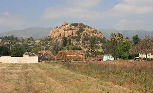
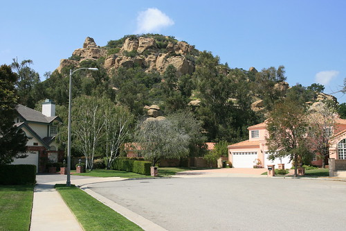
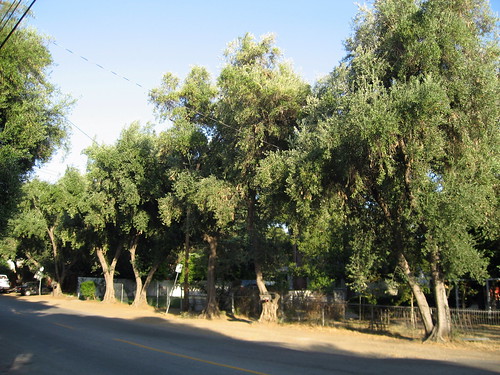
Southeast from the Intersection of Woolsey Canyon Road and Valley Circle Boulevard, Chatsworth – map
Declared: 4/2/75

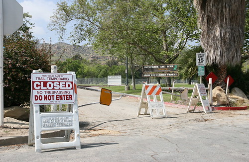
Welcome to Chatsworth, the Land Of Historic-Cultural Monuments You’re Not Really Allowed To Get To.

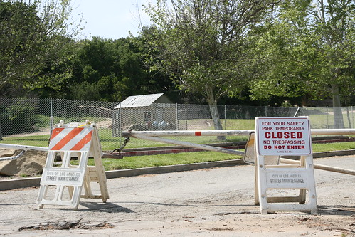
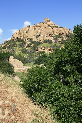
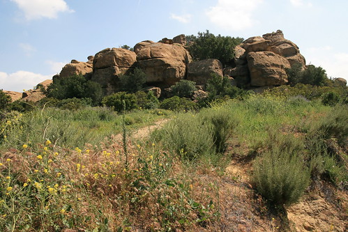
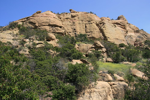
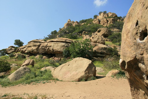
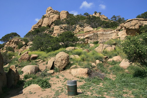
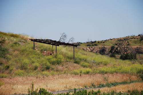
HCM No. 142 is a centuries-old kiln used for burning limestone in the making of lime for concrete, mortar, and whitewash, a step in the construction of bricks and tiles, most notably by Indians for the nearby San Fernando Mission. The spot was ideal for a kiln operation, the area being rich in oak trees and with a good amount of lime deposits. It’s estimated that, at one time, there were as many as five kilns like this in the area. By the time our kiln was landmarked in the mid-seventies, it had already been the subject of serious wear and tear. (It’s thought, prior to the monument’s designation, a backhoe may’ve obliterated the kiln’s vents, arches, and flues. Something did, at any rate.)

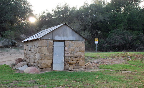
The kiln, also known as the Chatsworth Calera (calera is Spanish for “limestone quarry” or “limekiln”), is basically a hole in the ground with walls of vitrified limestone and brick. It measures about fifteen feet deep and six and a half feet across.

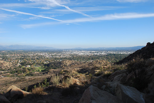
Incredibly, the site of the former, larger Chatsworth Reservoir, drained in 1969, remains free of development. For the latest on plans for the old reservoir’s future, read A Cultural Resources Study for the Proposed Wetland Riparian Restoration Program at Chatsworth Reservoir, Chatsworth, Los Angeles County (don’t worry, it’s not much longer than its title). A study from this past March 25 by Robert S. White, Laura S. White, M.A., and David M. Van Horn, Ph.D. through Santa Barbara’s John Minch & Associates, Inc., it’s from where are I pulled this handy map of the site.

Chatsworth Reservoir Kiln Site

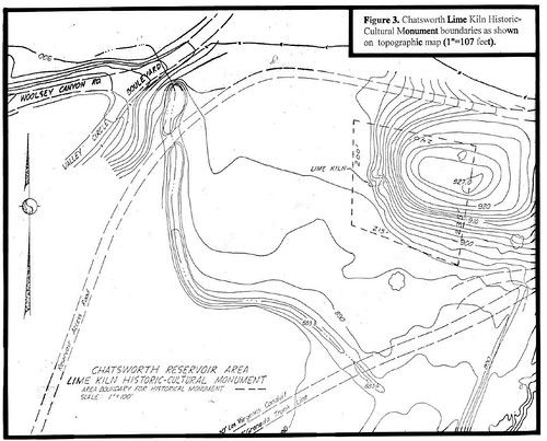
Honestly, I’m not convinced the map above jibes with the actual site all that well. According to the map, the kiln would lie about 400 feet from the intersection of Woolsey Canyon Road and Valley Circle Boulevard. That’s 1.33 football fields, about half a football field more than at which I would’ve guessed the distance.

The plan to preserve forty-four acres of the 1,318 Chatsworth Reservoir property as riparian and wetland habitats by Browning-Ferris Industries is in exchange for the company's destroying habitats through its landfills near Sylmar.

The report says the old kiln is in need of stabilization. It also recommends the recently burned lean-to be reconstructed and enlarged.

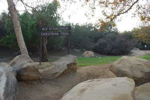
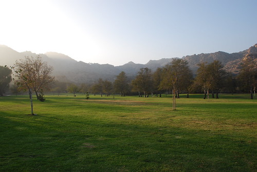
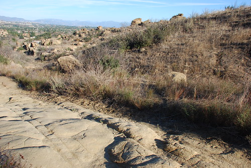
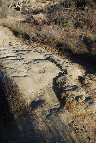
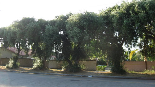
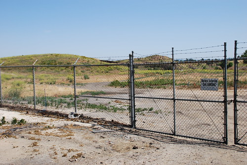
Chatsworth is in the middle of a monument crisis. No. 92, the Old Stagecoach Trail, and No. 133, the Minnie Hill Palmer House and Dynamite Shed, are currently off limits due to Chatsworth Park South being shut down for its soil’s ongoing lead tests. On the positive side, while access to No. 142 is limited to L.A. DWP workers, you can still see a bit of the old kiln and that burned lean-to from where Woolsey Canyon Road and Valley Circle Boulevard meet.

Chatsworth Reservoir Kiln Site

Up next: Smith Estate

continue reading...

Monday, April 14, 2008

No. 133 - Minnie Hill Palmer House and Dynamite Shed

Chatsworth Park South - Dynamite Shed

Minnie Hill Palmer Residence and Dynamite Shed
c. 1913, c. 1900
Chatsworth Park South, Chatsworth – map
Declared: 11/20/74, 11/20/07

Okay, there are two different halves to Los Angeles Historic-Cultural Monument No. 133: the former home of Minnie Hill Palmer and a small dynamite shack. Both are located in Chatsworth Park South and are combined into one official landmark for the sake of proximity.

Chatsworth Park South

The Minnie Hill Palmer Residence is run by the Chatsworth Historical Society and is open the first Sunday – for just three hours – of every month. That is, it’s open when the park in which it’s located isn’t closed as the Environmental Protection Agency tests its soil for high levels of lead. Which it is. In other words, Chatsworth Park South has remained closed since Valentine's Day, thereby making the Minnie Hill Palmer Residence off limits. Sorry.

From the Department of City Planning website:

Minnie Hall Palmer Residence

If you were allowed in the park, you’d see a redwood cottage (above), the second home built on what was once a 230-acre ranch homesteaded by James David Hill and his wife, Rhoda Jane, in the spring of 1886. Their daughter, Minnie, the seventh of their eighth children, was born later that year. Minnie, except for some time spent down in Hawthorne and up in Montana, lived most of her life on the homestead, a big chunk of it in this bungalow, built in 1911 or 1913.

Here’s a portrait of Minnie taken by Kevin Hass on May 4, 1980, about a year before her death. It's part of the collection of the Chatsworth Historical Society.

Minnie Hill Palmer

The Minne Hill Palmer Residence is also listed on the National Register of Historic Places. Today, when there’s not EPA soil-testing going on, the landmark is rented out for receptions, private parties, movie shoots, and small weddings (“I now pronounce you man and – hey, does anyone else smell lead?”).

Much closer to – and viewable from – the Chatsworth Park South entrance stands the Dynamite Shed, tacked onto HCM No. 133 thirty-three years to the day the Hill Palmer Residence got its designation. Built between 1890 and 1900, it’s a one-story structure built to house dynamite during the construction of the Southern Pacific Railroad’s Susana Pass Tunnel between 1898 and 1904. The picture of the shed at the top of the post was from when I visited the park back in December to visit HCM No. 92, the Old Stagecoach Trail, now also off limits due to that lead-testing in the park.

Chatsworth Park South

Today, the Dynamite Shed is rented out for receptions, private parties, movie shoots, and small weddings (“I now pronounce you man and – hey, can we can go easy on the lit candles?”).

Up next: Crossroads of the World

continue reading...

Friday, April 11, 2008

No. 132 - Stoney Point Outcroppings

Stoney Point Outcroppings

Stoney Point Outcroppings
Topanga Canyon Boulevard and Santa Susana Pass Road, Chatsworth – map
Declared: 11/20/74

When taking pictures at Stoney Point in Chatsworth, I ran into a man who first scaled this prehistoric rock formation forty years ago. Since then, he told me, he’s climbed all over the world, and he’d bet that more rock climbers learned how to climb at Stoney Point than anywhere else on earth.

Stoney Point Outcroppings

The Stoney Point page at Mountain Project says that many great climbers trained and practiced at the Los Angeles landmark early in their careers, climbers including Royal Robbins, Yvon Chouinard, Bob Kamps, Ron Kauk, John Long, and John Bachar. The website also lists about thirty different Stoney Point climbing routes, including Beethoven’s Wall, Turlock, and Nabisco Canyon.

Stoney Point Outcroppings

See a series of Stoney Point climbing videos on Jon McCartie’s Vimeo site.

Stoney Point Outcroppings

If you’re ever in the area, even if you’re not a climber, you should still stop by Stoney Point, today a 76-acre Los Angeles city park. Even at its base, you can make out all sorts of caves, potholes, and dens throughout the formation, perfect for 19th-century bandit-hiding. When there, I saw not only boulderers but also strollers, taking in the site. Sadly, patches of graffiti were unavoidable.

Stoney Point Outcroppings

I stopped by Stoney Point last Sunday afternoon. On any other day, I would’ve been following in the footsteps of Robbins, et al, scrambling up the cliffs and crags, but, unfortunately, I left my biners and grigri back in the car. In addition, it looked like a significant amount of work.

Stoney Point Outcroppings

Up next: Minnie Hill Palmer Residence and Dynamite Shack

continue reading...

Tuesday, December 4, 2007

No. 92 - Old Stagecoach Trail Property

Old Stagecoach Trail Property

Old Stagecoach Trail Property
Chatsworth Park South – map
Declared: 1/5/72

Not a great post, sort of half-assed. But I will say this: I sweat more getting these shots than for nearly all the other monuments combined (not including Plaza Park back on that sweltering Labor Day, of course).

Old Stagecoach Trail Property

I trekked out to Chatsworth Park South and the Santa Monica Mountains a few weeks ago to look for the plaque put up by the Native Daughters of the Golden West in 1939. It was placed to commemorate the 19th-century stagecoach trail that led from the San Fernando Valley, over the Santa Susana Pass, into Simi Valley, and beyond. I veered in the wrong direction, though, and couldn’t find squat.

So I re-trekked it back on the first Sunday of the month to get some assistance from the folks at the Chatsworth Historical Society, headquartered in the park. Helen, Betty, and Jim were a big help. Thanks. The first thing they did was point out the location of the sign, way up on the mountainside, to which I dutifully hoofed it.

Chatsworth Park South

Once an Indian trail, the pass was given a few names during the Spanish Colonial era, and all incorporated the name of the 3rd-century martyr St Susana. In the early 1800s, it was suggested the Santa Susana Pass might be a shorter/better route between the San Buenaventura and San Fernando Missions as opposed to the El Camino Real, the road whose raison d’ĂȘtre was to connect the missions.

Old Stagecoach Trail Property

The pass continued to be used more and more as control went from Spain to Mexico to the United States, like for agricultural goods, cattle, sheep, and eventually mail.

In 1859, the state put up $15,000 to fix up the Santa Susana Pass Wagon Road, under the supervision of James P. Thompson. Thompson was also the man awarded the contract to use the pass for carrying mail. The first overland stagecoach to use the pass made its run between San Francisco and Los Angeles on April 6, 1861. The trip took 72 hours.

Old Stagecoach Trail Property
That's the trail, right there.

Another thing the Historical Society crew tipped me off about was the Devil’s Slide, the portion of the trail where the grade was so steep that extra precautions were needed to prevent accidents involving runaway coaches. These precautions included tricks such as tying wheels together, using a windlass, blindfolding easily spooked horses, and cutting step grades into the stone paths.

Old Stagecoach Trail Property

The Santa Susana Pass became the main transportation link between L.A and San Francisco during the Civil War and remained so for about a dozen years. However, a group of new owners abandoned the stage line in 1875, although local ranchers and farmers continued to use the pass. The Chatsworth Grade Road (pretty much the 118 today), built in 1895, rendered the old Santa Susana Pass obsolete.

Old Stagecoach Trail Property

The Topanga Parlor of the Native Daughters of the Golden West placed the commemorative tiled plaque by Devil’s Slide on St Patrick’s Day in 1939. Yeah, the plaque’s misspelled. One of the participants in the dedication was John Steven McGroarty.

Old Stagecoach Trail Property

So while I did find the sign after it was pointed out, I was clueless when it came to spotting old pick and ax marks and retaining walls and such. I was also disappointed when I couldn’t discover some old cisterns used to water the horses. But, most disappointing of all, I couldn’t find the remains of the De la Osa swing station where extra horses would be hitched to stagecoaches to help with making the arduous trip up the side of the hill (or unhitched after the way down). All this stuff is still to be found, along with remnants of the quarry days from a hundred years ago.

Now, are these stagecoach ruts in the two pictures below?

Old Stagecoach Trail Property

After telling the Historical Society gang how I came up fairly empty on my search for stagecoach trail remains, I was encouraged to get in touch with the Santa Susana Mountain Park Association (SSMPA), a non-profit group founded in 1970. The group gives guided hikes of the trail and Santa Susana State Park on the third Sunday of each month. Will do.

Old Stagecoach Trail Property

One thing that is hard to miss, even for me, is the structure at the entrance to Chatsworth Park South. During the area’s mining days, this little building was a dynamite shack (coincidentally the name of my funk band in the 70s).

Chatsworth Park South - Dynamite Shack

If you want to know all there is to know about Santa Susana State Park and its history, read Alexander D. Bevil’s comprehensive historic overview from this spring and 2005’s archaeological overview by Marla Mealey and Natalie Brodie. Both publications are from California State Parks, and they’re where I got much of this post’s information.

Up next: Pepper Trees

continue reading...

Saturday, July 28, 2007

No. 49 - 76 Mature Olive Trees

76 Mature Olive Trees

76 Mature Olive Trees
1893
Lassen Street between Topanga Canyon Boulevard and Farralone Avenue, Chatsworth – map
Declared: 5/10/67

So what was up with all designations of tree-related Los Angeles landmarks back in the 1960s? Including the Chavez Ravine Arboretum, a full six of the first forty-nine monuments declared are trees. I’m not sure what percentage that is, but fraction-wise it’s pretty close to 6/49.

76 Mature Olive Trees

According to this website of the Chatsworth Chapter of the Daughters of the American Revolution, these trees were planted in 1893 by N.A. Grey, the Lassen Street property owner. It also claims the trees were begun from the cuttings of olive trees at the San Fernando Mission.

76 Mature Olive Trees

76 Mature Olive Trees

If you’re ever bored on a weekend and feel like driving to Chatsworth to check out these 76 Mature Olive Trees, don’t do so at my urging. First of all, the DAR website says the trees are now down to 49 from the 76 of 1967. And the way they stand and are maintained, the effect of witnessing them in person isn’t all that remarkable. If it were up to me, I’d go to other Chatsworth sites instead.

76 Mature Olive Trees

Up next: Mission Wells & the Settling Basin

continue reading...

Saturday, April 14, 2007

No. 14 - Chatsworth Community Church

Chatsworth Community Church

Chatsworth Community Church
1903
22601 Lassen Street, Chatsworth – map
Declared: 2/15/63

This is the oldest public building in Chatsworth, and, standing outside it, you’ll forget you’re in Los Angeles, imagining instead you’re somewhere in New England. I mean, even the weather was New English when I was there.

Chatsworth Community Churc

Early in Chatsworth’s history (in the latter half of the latter half of the 1800s), an informal congregation held services where they could: out in the open; in a schoolhouse; in each other’s homes. A formal congregation called the Methodist Episcopal Church was established in 1888. Just after the turn of the century, Nelson A. Gray donated land at 10051 Topanga Canyon Boulevard for a church to be constructed.

Chatsworth Community Church

Also known as Pioneer Church, it was, especially in those early days, a true community church. Built completely with volunteer labor,
“the building served as a community headquarters, used for weddings, funerals, christenings, church suppers, recitals, social events, community meetings, and even Chamber of Commerce meetings were held there. In 1904, high school classes were held in the church.”
Expanding the meeting space, the White Oak Hall part of the building was added in the early 1920s.

Chatsworth Community Church

The building was renamed the Chatsworth Methodist Church in 1959, and soon after was abandoned for a larger building. When a new owner announced plans to demolish the structure for a shopping center, the Chatsworth Historical Society was formed to push for the church’s official historical status. After designation in early 1963, the building was donated by the owner to the Society, provided they move it off the property within a month. It was relocated inside Oakwood Memorial Park in January of 1965.

Chatsworth Community Church

Rehabilitation to the old church was slow going what with lack of funds and excess of vandalism. While rededication ceremonies were held in 1976, it wasn’t until five years later that a new congregation began to hold services here. Since that time, the congregation of St. Mary the Virgin Anglican-Rite Catholic Church has occupied the building.

Chatsworth Community Church
This newer bell’s history with the church goes back to 1993.

I would have loved to have nabbed a peek inside the church, and I figured early afternoon on Easter Sunday would’ve been a good time, but it was locked up. However, the Chatsworth Historical Society holds an open house from 1:00 p.m. to 4:00 p.m. the first Sunday of every month.

Chatsworth Community Church

A detailed history of Pioneer Church, from where much of the above information (like that block quote) was gotten, can be found here. And go see the homepage for the Chatsworth Historical Society. Finally, Lila Swartz Schepler’s 1988 history of the Chatsworth United Methodist Church is here.

Up next: Towers of Simon Rodia

continue reading...